New features of Quantum GIS
Current situation and next steps
Paolo Cavallini
QGIS is going strong
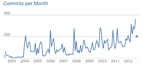
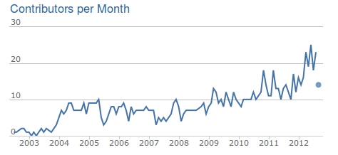
QGIS is not a desktop GIS
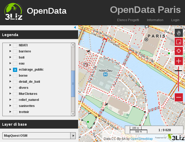
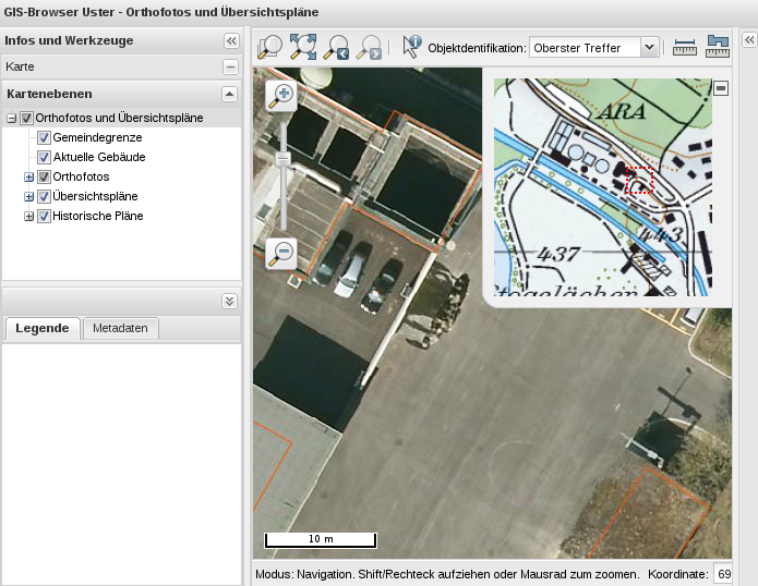
- Well, not only
- QGIS server
- two different web browsers
Good advices
- First: upgrade
- Second: if you have problems, let us know
- Third: if you have problems, let us know!
- So, what's new in 1.8 "Lisboa"?
- Lots of bugs fixed, more stability, blabla
- But also:
Browser
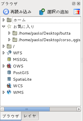
- Unified panel for raster, vector, databases and Web Services
- Double-click or Drag & Drop loading
- Direct reading of zipped and gzipped layers
Databases
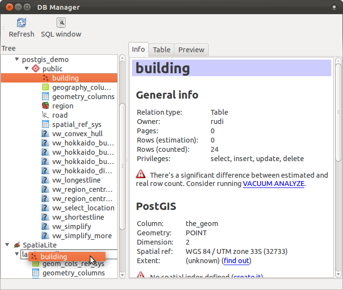
- DB Manager
- moving layers between shapefiles, PostGIS and SpatiaLite
- Drag & Drop!
- create Query layers
- Manage your database
- Native support for MicroSoft SQL Server Spatial
Expressions
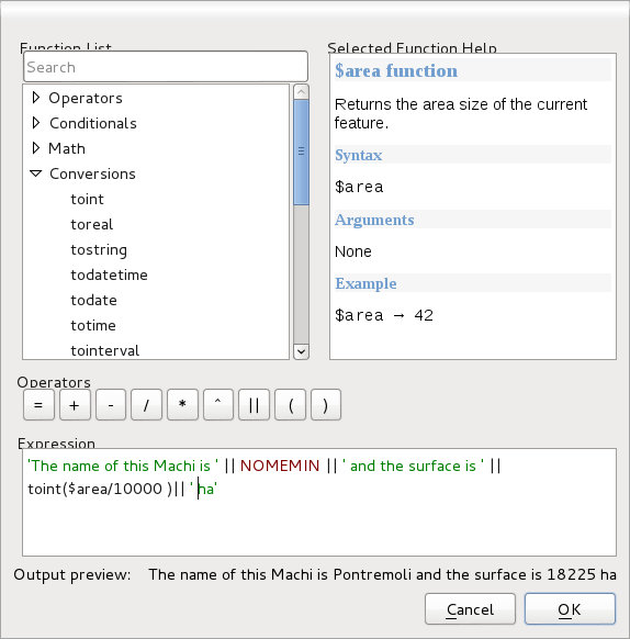
- Expression based labelling
- Expressions in Field calculator
More symbology
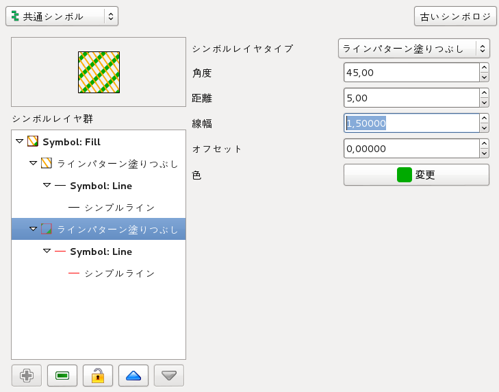
- New fills
- custom grids
- custom point
- Ellypse, rectangle, triangle symbols
- Copy and paste styles between layers
- Legend-independent drawing order
- Easier layer grouping
- Import-export of Styled Layer Descriptor (SLD)
Layer embedding
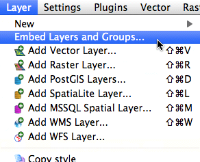
- Nesting projects within other projects
- the link is dynamic: when the source project changes, all the derivates are changed
- very good for consistency in groups of users
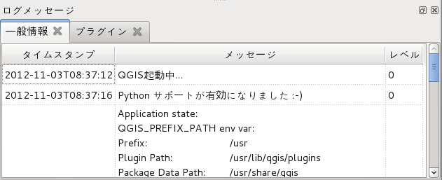
Message log
- All the diagnostic can be shown
- success
- warnings
- errors
Interface customization
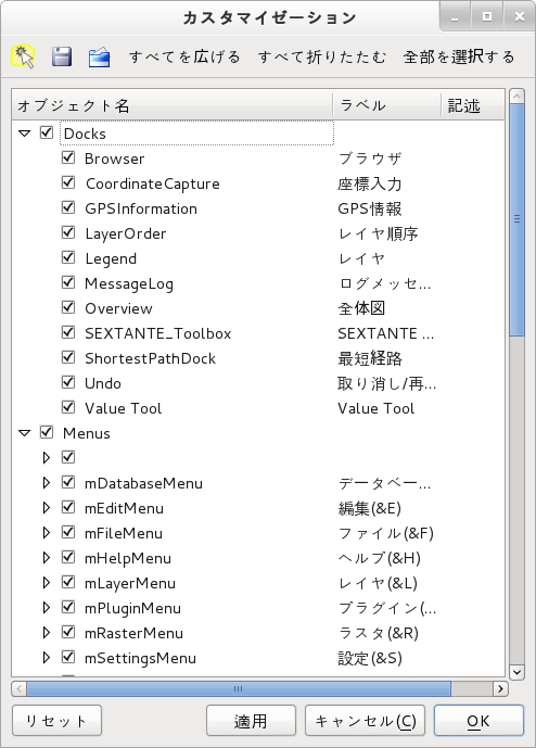
- The interface of QGIS can now be entirely customized
- Customization can be saved and applied to other PC
- Useful for schools, fieldwork, specialized uses
Direct Actions
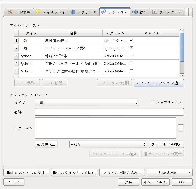
- Now you can run Actions with a single click on the map
- Useful default actions
More analyses

- New tools for terrain analysis (slope, aspect, etc.)
- ... and for nice shaded maps
- Heathmaps
- concentration of points
- user-selectable decay rate
New plugins infrastructure
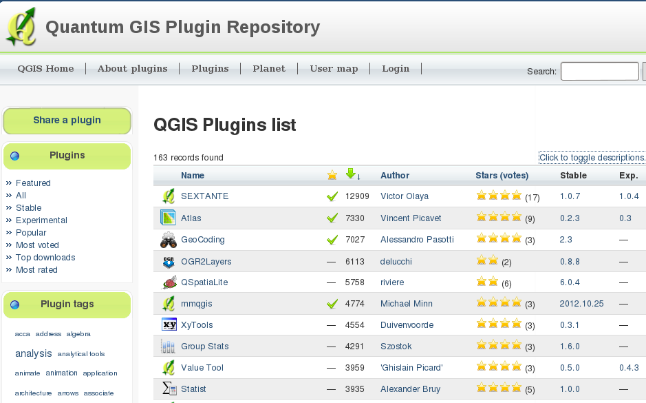
- Centralized
- More info
- Votes
- Publish your own!
Lots of plugins
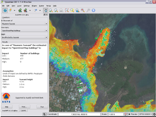
- InaSAFE (Indonesia Scenario Assessment for Emergencies)
- natural hazard impact scenarios for planning, preparedness and response activities
- sponsored by World Bank
Lots of plugins
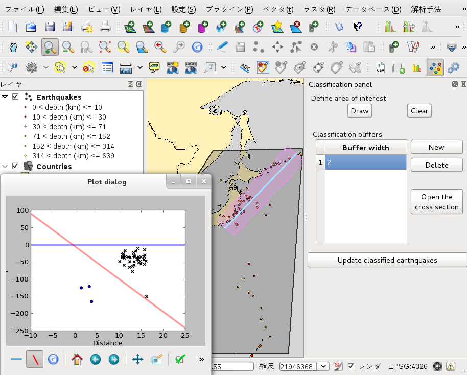
- GEM-MT (Global Earthquake Model - Modeller Toolkit)
- earthquake classification and analysis
- sponsored by Australian National University
That's not all
- See a complete list at:
Near future: ready
- Thousands of color ramps, vector and raster
- Raster overhaul (including symbology)
- Raster resampling
- Raster Save as... function
- Diagrams overhaul
- Python console overhaul (syntax highlighting, autocompletion, etc.)
- HTML support in map tips
Near future: ready
- Printing
- HTML support in print composer
- On the fly overview map in print composer
- Atlas integration for composer
- Multipage compositions
Near future: ready
- Web services
- Web Map Tile Service (WMTS) Client Support
- Web Coverage Service (WCS) Client support
- Support for geometryless WFS tables
- Improved SLD support
Near future: must be
- SIP Bindings revision
- Symbology overhaul
- Labelling overhaul
- Web site and docs update (new system)
Near future: must be
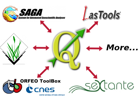
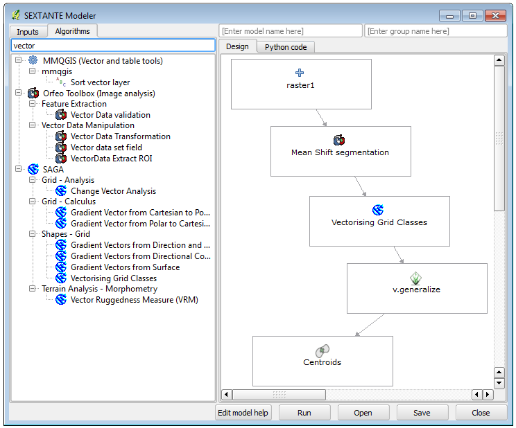
- SEXTANTE analysis framework integration
Near future: maybe

- Fixed 3D globe
- Oracle native provider
- Universal usage of expression builder
- Transactional WFS support for QGIS Server
- Multi-threading
- faster, progressive, non-blocker
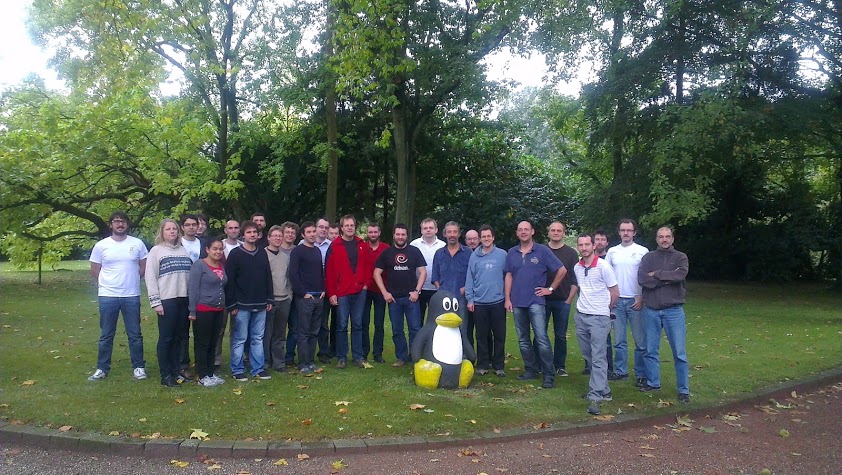
In QGIS, every user counts
Happy free mapping!
Licence of this presentation
Creative Commons Attribution-ShareAlike 3.0 Unported (CC BY-SA 3.0)
- You are free:
- to Share — to copy, distribute and transmit the work
- to Remix — to adapt the work
- to make commercial use of the work
- Under the following conditions:
- Attribution — You must attribute the work in the manner specified by the author or licensor (but not in any way that suggests that they endorse you or your use of the work).
- Share Alike — If you alter, transform, or build upon this work, you may distribute the resulting work only under the same or similar license to this one.